CGIS Planning Software
CTECH JSC
2022 – 2025
Fullstack Developer
Urban planning software based on GIS data for multiple provinces in Vietnam.
Project Gallery
1 / 2
Project Overview
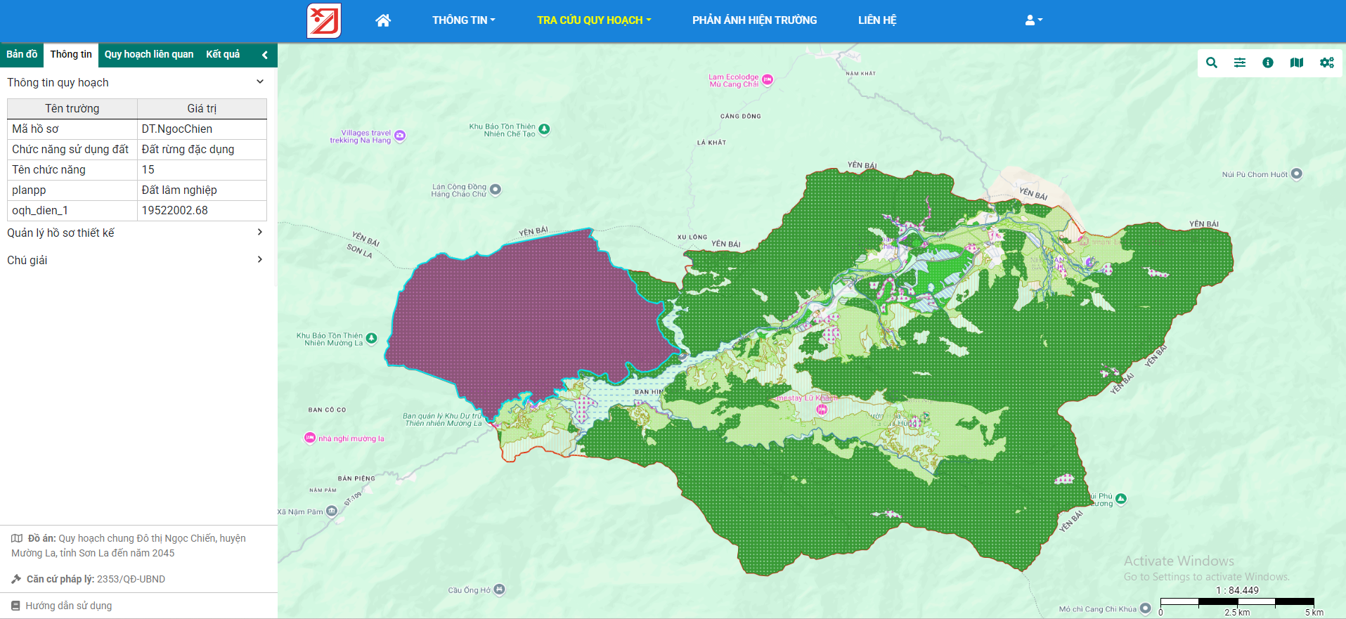
CGIS is a sophisticated urban planning software that leverages Geographic Information System (GIS) data to provide comprehensive planning tools for multiple provinces in Vietnam including Ho Chi Minh City, Son La, and Phu Tho. The application is built with .NET Core and WebAPI on the backend, with a modern ReactJS frontend written in TypeScript. PostgreSQL with PostGIS extension handles the spatial data storage and queries. The system allows government officials to manage urban planning data while providing citizens with transparent access to planning information through public portals.
Technologies Used
6 technologies
.NET Core
WebAPI
ReactJS
PostgreSQL
TypeScript
GIS
Key Features
6 main features
- Interactive GIS mapping with multiple layers
- Urban planning visualization and data management
- Spatial data analysis and reporting
- Multi-layer information display with filtering options
- User-friendly interface for non-technical users
- Public access portal for citizens to view planning data
My Responsibilities
4 key responsibilities
- Maintained and upgraded system features
- Researched and applied new technologies to improve UX
- Implemented GIS data visualization components
- Optimized database queries for large spatial datasets
Demo Links
Live demonstrations of the project
Project Categories
Web
Gis